Canyonlands National Park

Canyonlands is truly a different world. It has been shaped by the mighty powers of the Colorado and Green Rivers. These two rivers converge in the middle of Canyonlands and divides the park into 3 distinct areas Island in the Sky, The Needles and The Maze. Island in the Sky is the most popular and populated areas in the park.

The Maze is a little-known land with little or no marked trails. The only way to get there is via high clearance 4-wheel drive vehicle and as the book says the “chutzpah” to drive it down the hair pin turns of “Flint Trail”. Arriving is only part of the challenge, you then have to explore a virtually unknown area without getting lost. Although we are here for adventure, this is one that we will skip.

The Needles is full of colorful spires of Cedar Mesa Sandstone and has many opportunities for day long hikes and overnight back country hiking and camping. There is also a scenic drive (on gravel roads) with a couple of shorter hikes. We want to see this part of the park, but have not made it down there yet, it is about 2 hours south of where we are staying, but stay tuned as we will go there eventually.

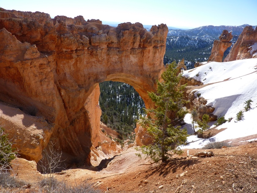
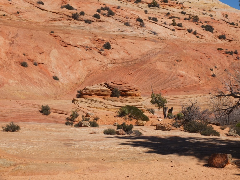
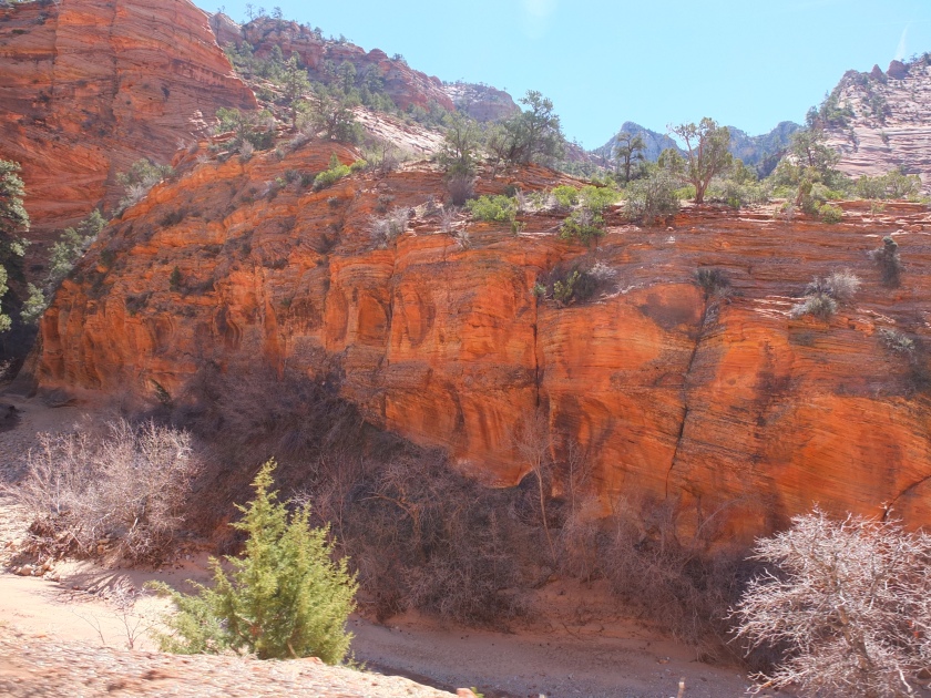
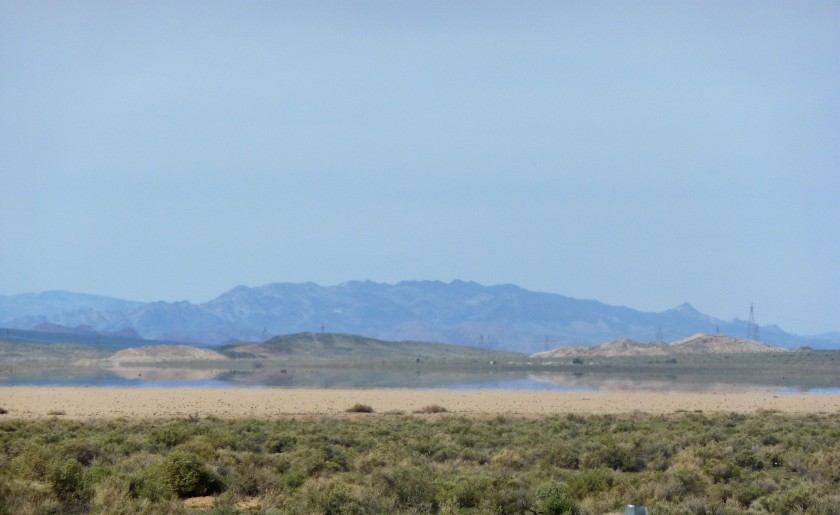
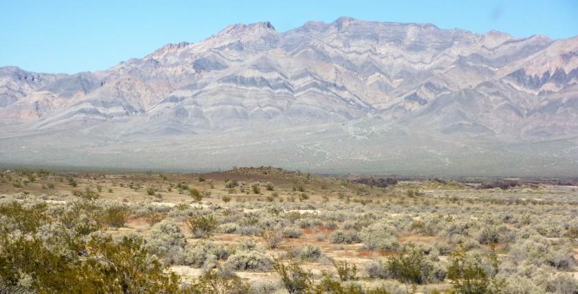
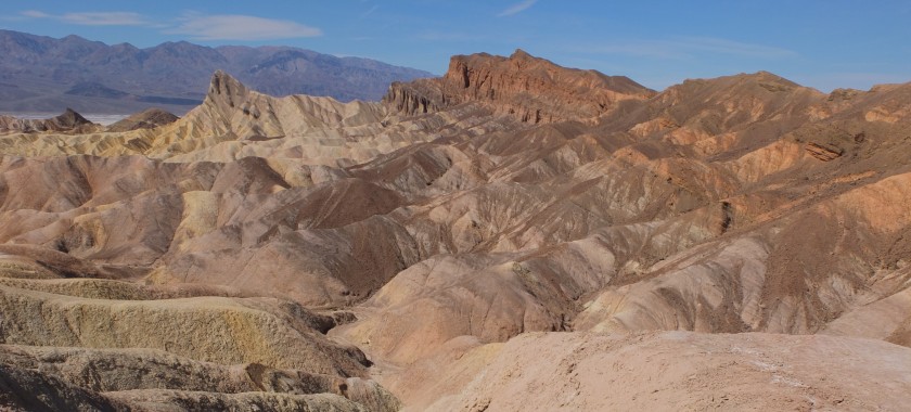
So far, we have only explored the Island in the Sky section. It is truly an Island in the sky at about 6,000 ft. it is a mesa of grassy fields and colorful buttes, it has a very unassuming appearance until you reach the edge. From there you look down about 1,400 feet to a lower layer of hills and valleys, that then give way to intricate canyons. The canyons are rimmed by a distinctive white sandstone that stand out against the greenish upper layer and grey canyons. The sheer size, and depth of the view is awe inspiring and a little frightening. You will notice a road near the white rim, it is a 100 mile backcountry road that is estimated to take at least two days by vehicle or 5 days via mountain bike, needless to say we are not planning on doing this trip.

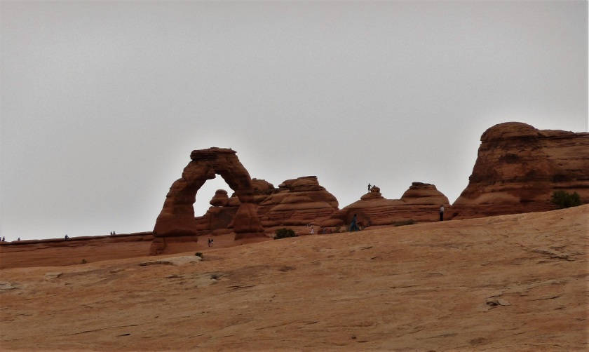
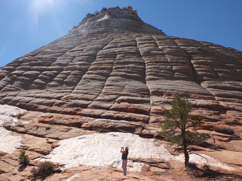
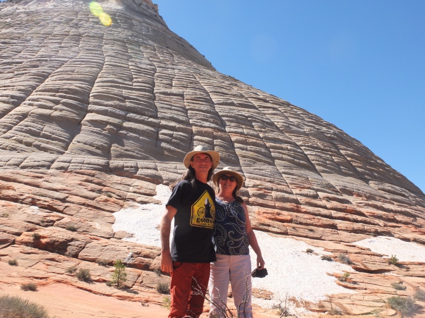
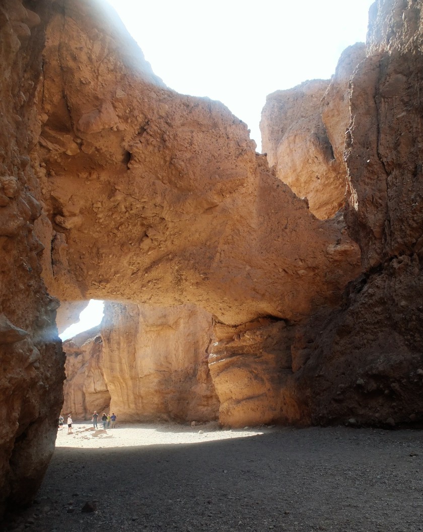
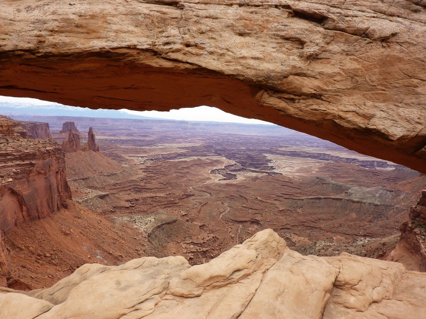
Anyway, pictures of the landscape, and an Arch on the edge of the cliff reminiscent of Arches NP about 35 miles away.

P1070902 (2)P1070903 (2)P1080051-0P1080068-0P1080071-0

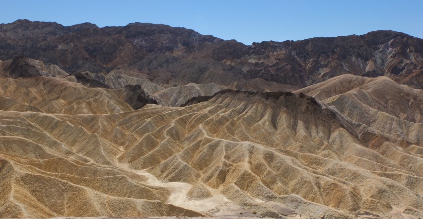
I have discovered a fear of heights that I really never knew I had. At the overlook in Joshua Tree Keys View, I was uncomfortable even experiencing a little vertigo but got used to it after a couple of visits. Same occurred at Dante’s View in Death Valley, but nothing like trying to hike the rim of Island in the Sky. There is an easy hike one mile out and back, we made it about half way and I just could not continue. I was not only uncomfortable for Randy and myself, but others on the trail kept getting so close to the edge and jumping from rock to rock that I was a nervous wreck. A little slack, but I didn’t see how the view could get better just by moving another half mile when you could see for 10s of miles all around. Below is the rest of the trail we choose not to do.

P1080084-0

There is also a crater called upheaval dome on the western edge of the mesa. We took the steep hike up to the rim of the crater for an amazing view. The crater is approximately 3 miles across and its origin is unknown. In geologic terms it is relatively young at less than 170 million years old. They speculate that it was either the result of a meteor strike or a collapsed salt dome. Recently (1990s) the theory of meteor strike has been supported by a study by a team of geologists and seismologists from NASA and the University of Nevada at Reno who performed a detailed study that included seismic refraction and rock mapping. In 2008 they also found shocked quartz which could only have been formed by the high pressure caused by a meteorite strike or a nuclear explosion. We buy the meteorite theory.

DSCF8079 (2)DSCF8085

Peace and Love!!


Arches

We arrived in Green River, UT on March 20 and are staying for a month. Green River is a very small rundown town, but is only ~50 miles north of Arches and Canyonland National Parks. The park used to be a KOA campground but is now A OK RV Park (hahaha) we are currently one of 4 RVs here and it is a 60 site park, the price is right so all is “A OK.”

The area is very desolate, you can just look at a map and see that there are few paved roads. But the natural beauty is breathtaking even the Interstate was beautiful. Can’t wait to explore the area more, but spent our first couple of days exploring Arches and Canyon Land.

Arches is a beautiful park with enormous red rocks. After having recently been to Bryce and Joshua Tree we have a new understanding of rock formations and how they are created which really made Arches very interesting. You could see Hoodoos in the making and wonderful examples of erosion via the arches and other formations. We are beginning to get used to large rocks, tall cliffs and amazing sites, the number of pictures are going down a little. Thank goodness for digital, not sure where we would put all the photos. We are learning so much and are so grateful for this opportunity we can’t imagine doing anything else.

Anyway back to the arches.

DSCF7992 (2)

Landscape Arch the most fragile in the park.

DSCF8012 (2)

Pine Tree Arch

DSCF8041 (2)

Broken Arch.

P1070899 (2)

Delicate Arch.

P1070951 (2)

Pine Tree looking up.

P1070960 (2)

Tunnel Arch.

P1070962 (2)

Tunnel Arch #2.

P1070968 (2)

Skyline Arch.


P1070974 (2)

Sand Dune Arch.

And theses are just a couple of the over 2,000 arches in the park.  There is another section of the park we want to explore further, but only so much time in a day so there may be more to come.

In addition to the arches there are just amazing views around every corner.

DSCF7929 (2)DSCF7938 (2)DSCF7942 (3)P1070964 (2)P1070972 (2)P1070978 (2)

That’s it for today.  Peace and Love.


Bryce…

After the crowds in Zion NP, we decided to get an early start to visit Bryce. Having an almost 2 hour drive from the campground in Kanarraville we missed sunrise but not by much. Bryce is an interesting park, smaller than many (Joshua Tree and Death Valley by far) and basically follows a mountain ridge. Being on a ridge means that most all hikes go straight down and if you take them you then have to get back up to the ridge, unless of course you are up for the under the rim trail which is over 20 miles. Needless to say, we are not going on a 20-mile hike. The most popular part of the park is the amphitheater which does have a trail around the rim which we did some of. Also, we took Nellie and she is not allowed on trails (excuses excuses). The rim walk is really a paved path and she was allowed there and at overlooks. This place is simply amazing.

The pictures below are from the amphitheater both early in the morning and later in the day. Our favorite view point was “inspiration point” and it was quite inspiring. We came back to it for our picnic of the day.

P1070831P1070839

P1070728P1070734P1070742P1070749

The spires or pinnacles are called Hoodoos. They come in all shapes and sizes and although they are very prevalent in Bryce you see them all over this area. The amphitheater has the most concentration of hoodoos, but you see them all over this park. As mentioned we did not get to the bottom to view the hoodoos from the bottom up, but next time maybe we will be more up for the hike and leave Nellie at home, bet that would be an amazing view.

After the amphitheater, we continued up the mountain ridge for the 18 mile scenic drive. There were several natural bridges, but pictured below is the most well-known. The end of the drive is at Rainbow point at 9,115 ft. of elevation and a lot of snow. Even with the snow it was not a cold as you may imagine, I took off the coat well before this as the day heated up to mid 50s.

P1070707

P1070761
This picture is interesting, the younger tree watching its future demise.


P1070783P1070788P1070792P1070801P1070812


Really loved this place.  Peace and Love!!

Parowan and Dixie National Forest

About 40 minutes north of us on I 15 is the little town of Parowan. They not only have the oldest rock church in southern Utah, but they have dinosaur tracks and petroglyphs. Sounds a lot like a tourist trap, but we decided to go anyway, they are very dog friendly so day trip for Nellie. The dinosaur tracks were less than overwhelming, but Nellie loved running and rock climbing. Our real question is, if they found a couple of these in all of these rocks, how!!! Did someone look over each and every one of these rocks, and if so did they just pick out random spots in the rocks that kind of look like foot prints?? Or is there real science.

P1070594

P1070591

The petroglyphs on the other hand were very impressive. You may have seen the ones we posted from Joshua Tree, well these are 10,000 times better and so many. They are all between a small cap in the mountains. See gap below.

P1070640

This particular petroglyph they call the zipper, and it is believed to be either a map of an excursion for hunting and vegetative land or they are astrological in nature and show times of the year, solstices’ and where the planets, sun, moon appear in the gap in the mountains.  A kind of solar/lunar calendar. Either way I say they are pretty cool


P1070636

Here are some other pics of the petroglyphs, you see animals, people, geometric shapes and other objects. No one really knows the meanings, but there are several interpretations.

P1070608aP1070616aP1070622aP1070626aP1070632a

Also, graffiti is nothing new see where these were defaced in the 1880s.

P1070609a

To fill out the day we drove up National Scenic Hwy 143 thru Brian Head (ski resort) and back around Mammoth Creek Road to Scenic Hwy 14 summit at over 11,000 ft. Beautiful drive, although I never saw a Mammoth or a large creek on that part. This was all in Dixie National Forest which is scattered all around the area. Although there was snow all around and pretty deep, it was not very cold. Beautiful area, if not so much snow we may have explored more.

P1070667a

P1070683a

P1070681 (2)

Peace and love!


ZION

DSCF7565 (2)

After looking closer at the map, we would not be able to get to Zion proper from the entrance closest to us at Kolob Canyons so we took the trek down to Zion proper arriving a little before 10am to find all parking lots full. We knew that Zion was one of the most popular NPs, but didn’t think that it would be that busy this time of year. It is rolling spring break in the middle of March, but still. Zion does not allow private vehicles in Zion Canyon (the most popular part) you have to take a shuttle that makes 9 stops up and down the canyon, but we were out of luck since there was no parking. Some people park at scenic pull outs near the canyon and hike to the shuttle pickup. I am not encouraging this and it is not allowed, but some do it anyway.

We decided to take the scenic drive down Hwy 9 which climbs steeply up the canyon, goes thru a 1.1-mile tunnel, and travels along the upper portion of the park. It is called the Zion – Mt Carmel Highway and was unexpectedly beautiful. The mountains were shorter but the views were spectacular and the tall views (close up) make my neck hurt. We probably spent over 4 hours on a 12-mile road. There are not marked trails, but we made our own. You could explore for hours at each scenic stop. Interesting note the tunnel was built in the 1920s and does not fit many of the larger vehicles we have these days. If your vehicle is 11’4” or taller or over 7’10” wide you have to make special arrangements and go thru the tunnel as a one lane road. Don’t think we will be taking the bus that way. Anyway here are pictures of that area.

P1070554

P1070523DSCF7725DSCF7721DSCF7696DSCF7617DSCF7609

DSCF7667DSCF7676

After the drive, we decided to check out the parking lot to see if there was a spot available later in the afternoon. We finally found one and jumped on the shuttle to explore Zion Canyon proper. We did a couple of hikes and enjoyed the ride, but have to say it was unimpressive after the views on the scenic byway drive. The canyon walls were very tall and from the shuttle you could not get the whole view. The hikes were nice, but very crowded. All in all, if we were visiting again and only had one day we would create more hikes on the Zion-Mt Carmel drive and skip the canyon all together. I believe we mentioned so some of you that we were missing trees and water, well Zion offered both!!   These pictures are mostly of the Riverside Walk in the Temple of Sinawava at the top of the canyon. Up there you have access to the “narrows” (without a trail), and we really wanted to go up a little just to see the ~20 ft wide cut in walls that must have been 1,000 feet high, but you had to cross the Virgin River to have any bank to walk on and we were not up to wet feet and hiking back.

DSCF7822P1070572P1070577

Note: Amazing that Zion was created by the Virgin River which also created the mountain pass we took to enter Utah from Arizona. This pass was beautiful and we thanked the river the whole way for not making it worse on our bird, we were not sure how we would get over those mountains. The bird did great and so did my driver. Peace and love.

Six More States…

Since our last list on January 6, we have stayed in six more states.  We are currently in Kanarraville, UT less than 10 miles north of an entrance to Zion National Park via Kolob Canyon, may not connect with the main canyon but we shall see.  Anyway cheers for six more states.  Our journey really slowed down in CA staying for a month in Desert Hot Springs and we believe we will stay around Southern Utah until at least the end of April??  But you never know.

P1060102 (2)P1060291 (3)P1060374 (3)P1060500 (2)P1070202 (3)P1070496 (2)

Please note that this list does not mean that we are at all DONE with any of these states, there is much more to see and hopefully many years to see it.  These are just our first time states.  Peace and Love.

Pahrump too…

We came to Pahrump because it was a cheap week stay, but have been surprised at the amazing things we have found to do (besides Death Valley).   Of course, everything is a long drive away, nothing has ever been right at our front door on this trip. We have learned to love the Jeep and the views as we travel from place to place. Also, out here (as opposed to NC and surrounding areas) EVERYTHING is a long way away. There are miles and miles of vast desert wilderness, which can be very beautiful, all surrounded by ever changing mountains. The colors and textures in the mountains (and valleys) never cease to amaze us.

Also on these day trips we change elevation a lot. From below sea level at the Salton Sea and Death Valley up to 5, 6, and 8,000 feet mostly 4,000 to 6,000 down to 1 or 2,000. It is a must to stay hydrated in the desert so we travel with several plastic water bottles each day. One interesting thing we have noticed is that when you go up and down the mountains the water bottles contract and expand if the lid is on tight crackling and popping the whole way!!! Hahaha true, just wanted to share one of our small giggles.

On our way to Death Valley day two, we decided to take the long way and go thru Beatty about 1.5 hours north and visit Rhyolite a ghost town about 4 miles west of Beatty. Gold was discovered in Rhyolite around 1904 and by 1907 it had a population of over 6.000. At its height, Rhyolite had access from 3 railroads, 50 saloons, 2 churches, 18 stores, 2 undertakers, 2 dentists, an opera house, a telephone company, electric power plant, 3 ice plants (necessary), 4 newspapers and 2 stock exchanges. Its height did not last long because although there was gold it was difficulty to extract. It is now a really interesting ghost town, you can see the grid lay out to the streets and several ruins of buildings including a three-story bank, jail house and rail road depot. The rest was either sold or pilfered.

P1070312 (2)P1070306 (2)P1070299 (2)P1070298 (2)

Although there are not many intact buildings, one that remains or has been restored is a bottle house. The structure is made of over 20,000 bottles which were used due to the lack of building materials. It is hard to imagine having this many bottles much less building a house out of them. Ideas for our next house??? But where to store the bottles in the meantime….

DSCF7354

DSCF7357
Find the bottle dated 1902.

At the ghost town was also the Goldwell Open Air Museum, which is an artist retreat as well. The Museum began in 1984 when Belgian artist Albert Szukalski created the first installation “The Last Supper.” Life sized ghostly figures posed after the famous Last Supper by Leonardo Da Vinci. It is really quite impressive and although looks fragile it must be pretty darn sturdy to have withheld being outside in the desert for over 30 years. Several other pieces were created here in the early 1990 by other well known Belgian artists. More recently they established a not for profit and have artist programs and residencies on site creating more works for the garden, but also indoors multipurpose studios, with performance and exhibition space.


DSCF7391 (2)DSCF7382 (2)DSCF7400 (2)

About 45 minutes south east just outside of Las Vegas is the Red Rock Canyon National Conservation Area, a 13 mile scenic drive with many hiking trails and rock climbing opportunities. If you ever find yourself in Las Vegas, you have to go. It is literally minutes from the city limits and only $7 entrance fee or free with our Pass Port America annual National Park Pass. You could spend a full day hiking and taking in the views.

DSCF7430 (2)DSCF7479 (3)P1070367 (2)

Another interesting spot we found are the Dublin Caves in Shoshone, CA. This small (population 31) town is about half way between Pahrump, NV and Death Valley. It not only has a free museum (small but interesting) but also cave houses. They say the caves were actively used from the early 1900’s until the 1960’s by miners and vagabonds. Caves are warm in the winter and cool in the summer and looked livable with stovepipe chimneys, alcoves on the walls, split level floor plans and an outhouse. Idea #2 for our next house???

DSCF7518 (2)DSCF7519 (2)P1070396 (2)

Ash Meadows National Wildlife Refuge is an oasis in the Amargose Valley part of the Mojave Desert about 22 miles west of Pahrump. This oasis was very different from the one we saw in Coachella Valley, instead of palm trees it had Ash and Mesquite trees and lots of what appeared to be marsh grasses. It is made up of several springs which put together pump 2,800 gallons of water a minute. I guess the Coachella oasis is from a spring as well (where else would the water come from?) but it must not pump as much as these. There were small streams all over the property and 2 large reservoirs with the clearest blue-green water you have ever seen. This was also the most water we have seen in a couple of months so that was refreshing.

P1070417 (2)DSCF7536 (2)

DSCF7545 (2)
Notice the water bubbling the sand up in the middle of this spring. Said this spring pumps 16 gallons a second.  A SECOND.

DSCF7530 (2)


Finally, on our trip across just outside of Baker, CA we saw a real live mirage. We have seen the shimmering on hot asphalt and the hot beach sand, but never a full lake with reflections of mountains that disappear the closer you get. It was truly an amazing site, the pictures did not come out that well, but I couldn’t not make mention of this site as we were both amazed!!! Until next time Peace and Love.

P1070375 (2)

Pahrump

DSCF7257 (2)

So you may have noticed that I have not been posting much lately. That is because of the picture only posts I did a couple of weeks ago. We were using our Verizon data at Sam’s Family Spa (not the parks data) and I didn’t realize how much it used to post all of those pictures. They used up over half of our data in the first days of the month, so I have not been able to post. Lesson learned.

We left the Coachella Valley on March 6 and moved to Pahrump, NV. We are about 60 miles east of Death Valley and 50 miles north west of Las Vegas. Small town and RV Park is our first Escapees Co-op park “Pair – A – Dice” which is running a week special for first time visitors, so we get a cheap week and not far from National Park #2.

The trip over was uneventful. We climbed over the San Bernardino Mountains at a low spot but still quite a climb, our Bird did great. Over the mountain, we went thru Barstow, CA the other end of Interstate 40. So although we didn’t drive on 40 during our trip we have now seen both ends. Below is the western end (or beginning) of Interstate 40.

P1070190 (2)

After getting out of California hustle and bustle we were treated to beautiful scenery and a whole bunch of open land. It has really been fascinating how much open land there is in CA. We have always thought of it as highly populated and gridlocked, but in SoCal only the first ~100 miles from the coast is that way. There is a whole lot of wilderness to be discovered. Part of the drive across…

P1070194 (2)P1070198 (2)P1070200 (2)P1070201 (2)

We entered Death Valley via scenic Hwy 190 and it was beautiful. After lots of desert we entered the mountains and around every bend was a spectacular view. It really is amazing how much the terrain can change and how fast.  Our first stop in the park was Dante’s View. A 5,000 foot view of the salt covered valley below and surrounding mountains.

DSCF7269 (2)P1070204 (2)

DSCF7270 (2)

DSCF7274 (2)

Death Valley currently received only about 3 inches of rain a year, and unbeknownst to us had a devastating flood in October 2015 when the northern portion of the park received 2.7 inches of rain in less than 5 hours. Parts of the park are still closed. The descriptions of the flood are truly scary 17 visitors and 3 rangers were stranded overnight at Ubehebe Crater and they noted 100 foot wide rushing water with 20 foot waves down Grapevine canyon near Scotty’s Castle. The major attractions in the northern portion of the park are closed and it is a very long drive up there so we will most likely skip that part of the park?? The torrential rains also brought a “super bloom” for 2016 a once in a decade event, too bad we are a year late. There was also a strong storm 90 miles south that damaged Badwater Road which has mostly been cleaned up, but you can still see some of the damage and Artist Palette Drive is closed for repairs but you can still see some of the colors from a distance. Would have loved to drive thru this natural display of color.

DSCF7319 (2)

During the day, we ventured from Dante’s point at 5,000 feet to 282 feet below sea level at Badwater Basin. Badwater is named because the water is very salty and unfit for drinking by animals or humans. It is said that years ago surveyors brought their mules to the water to drink but had no luck and denounced it as bad water. This is the lowest point in North America that is not covered by water. There are vast salt flats that really look like snow. Guide books tell you not to walk out in the hot summer months, while we were there it was cool for Death Valley, high in mid 70s. .

DSCF7334 (2)P1070265 (2)P1070267 (2)P1070268 (2)

In another part of the salt flats there is an area called “Devil’s Golf Course”. I don’t really get the name (I’m not a golfer) but I don’t think I could even find a ball in this mess. It is an immense area of rock salt eroded by wind and rain into jagged spires or sharp salt formations. They say it is named that because “ only the devil could play golf on such rough links”?? They also warn of walking out into the spires because they are so sharp that they can cut thru leather shoe soles!!! Much less skin if you run into it or heaven forbid lose your balance.

DSCF7314 (2)P1070245 (2)DSCF7312 (2)

Although many of you have probably seen (and we have also) the natural bridge in NC mountains, we took the hike to a natural bridge in the park. Not as impressive as NC’s, but cool none the less. It was a hike up a canyon to the bridge and as pointed out at the kiosk we noticed where it looked like the canyon walls were painted and the paint dripped in areas (see pictures below).   This is because the canyon walls are so hot sometimes that when it rains on the mountains above and sediment washes down it drys on the canyon walls before it reaches the ground, thus appearing to paint the canyon walls. Wow just wow, so glad we are here in March.

DSCF7330 (2)P1070256 (2)

My favorite spot of the day was Zabriskie Point located in the Valley’s bad lands. The colors were amazing more so than the pictures give credit. Vibrant yellows and browns mixed in. It is unworldly looking. The fingers are relatively small compared to other views, but just astonishingly beautiful. As with many places we have visited I hear it is beautiful at sunset, but since we have been staying ~an hour outside of the parks and we have Nellie to get home to our days out are usually around 9 til 4 or so, so we usually experience sunset at home. Enjoy the view…

DSCF7291 (2)DSCF7295 (2)P1070230 (2)

Day one at Death Valley was marvelous, hope you have enjoyed. Thanks to Pair A Dice RV Park for the internet connection (clubhouse access only). Peace and Love.