South from Gold Beach Hwy 101

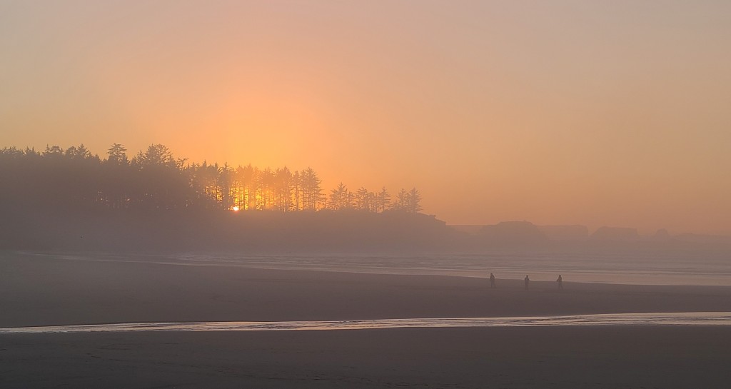
From Gold Beach south on THE ONLY HIGHWAY 101 (north or south).  Not saying this is bad, but this part of Oregon is really very sparsely populated this time of year and there are literally no options on how to get somewhere.  Before going east you have to travel at least an hour south or two north from GB.  But I digress, just south of “home” is Cape Sebastian, Myers Beach, Pistol River and the Samuel Boardman Scenic Corridor.     

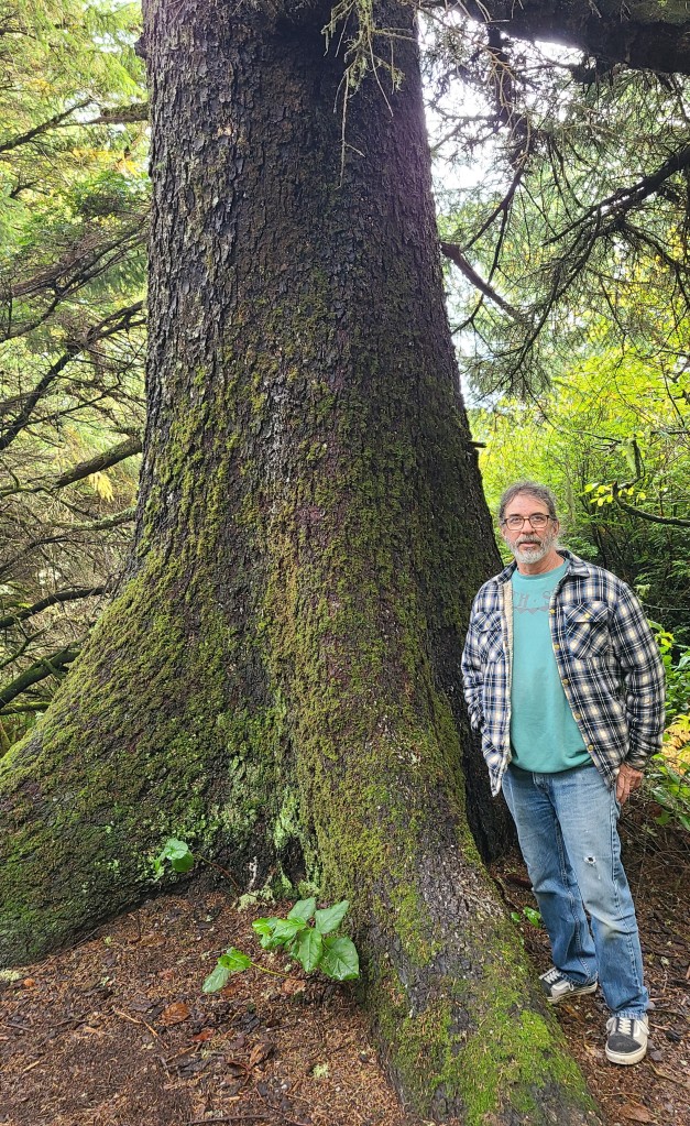
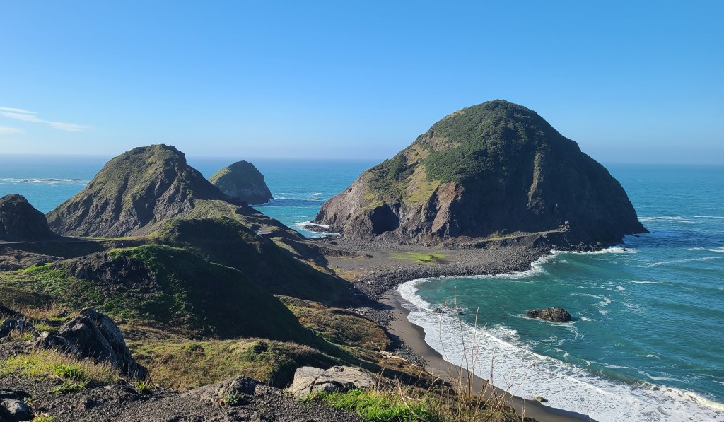
Cape Sebastian is the mountain in our home beach pictures looking south.  It is covered in Sitka Spruce trees which are what I think of as the typical Oregon forest, the old branches covered with moss and looking like a ladder.  The overlooks are over 200 feet above sea level and on clear days provide spectacular views. 

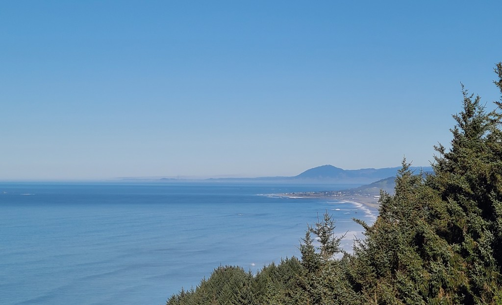
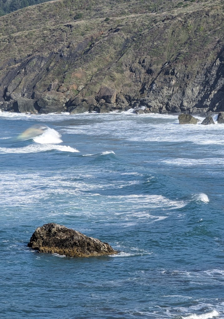
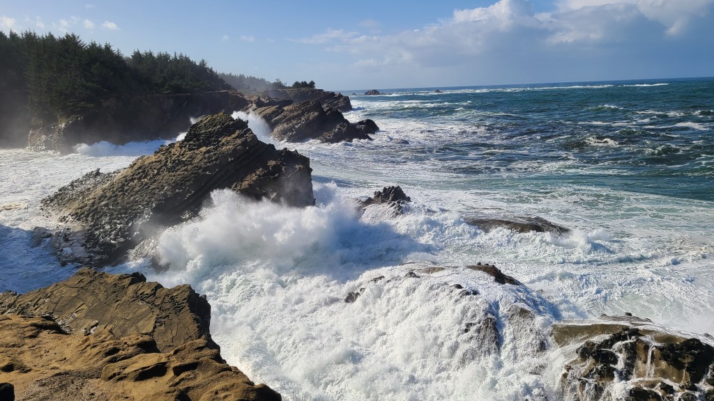
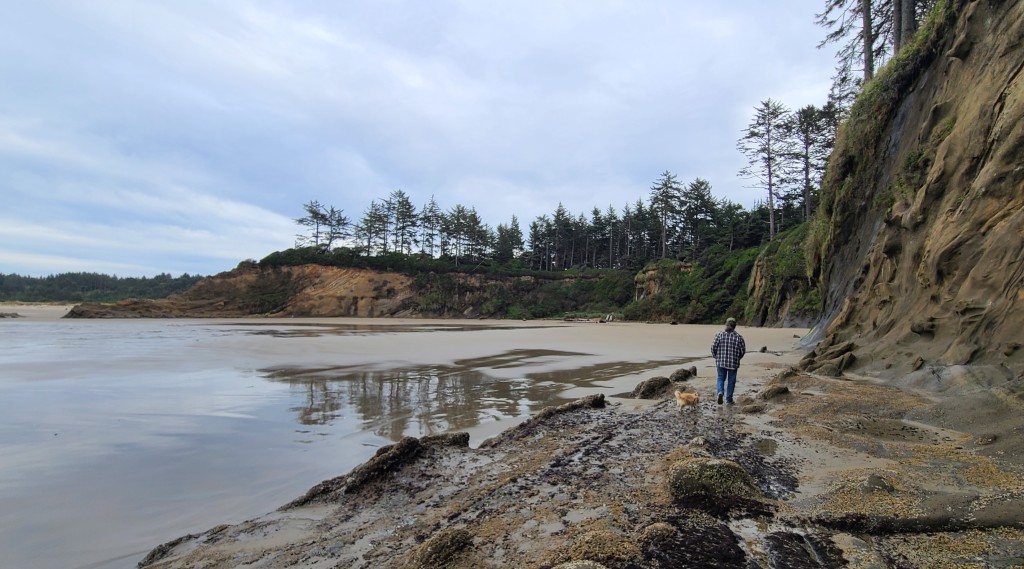
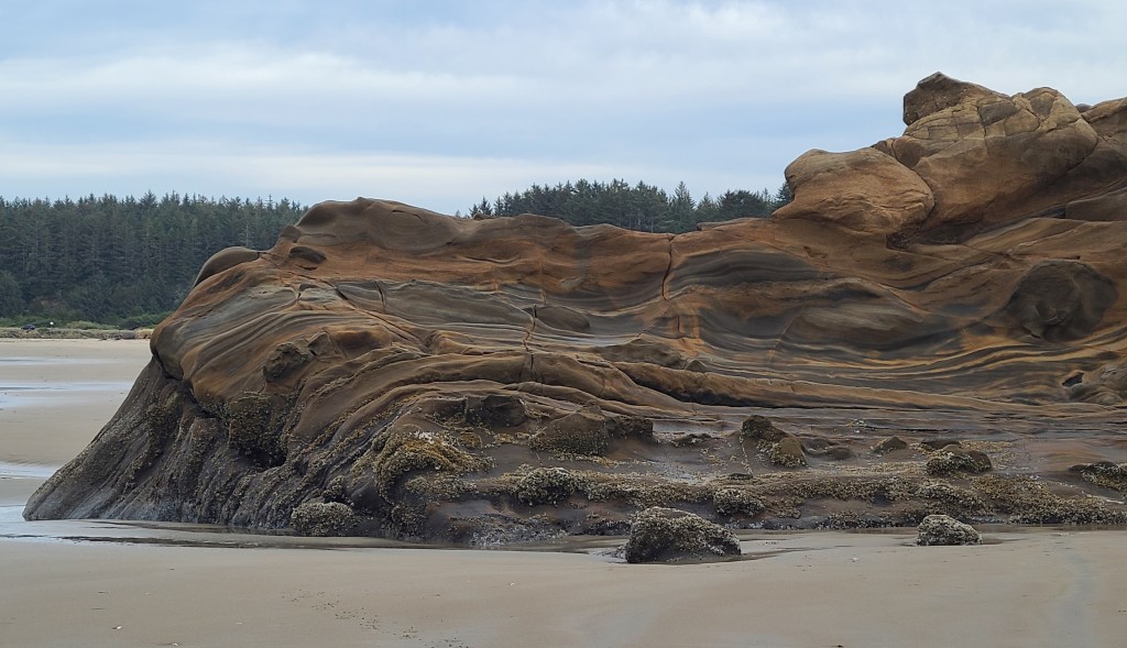
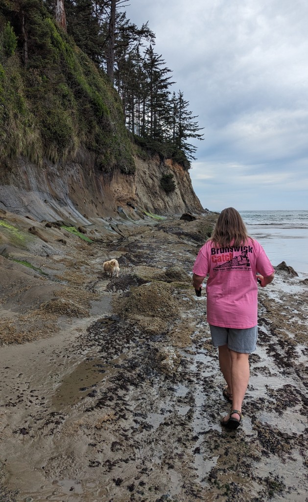
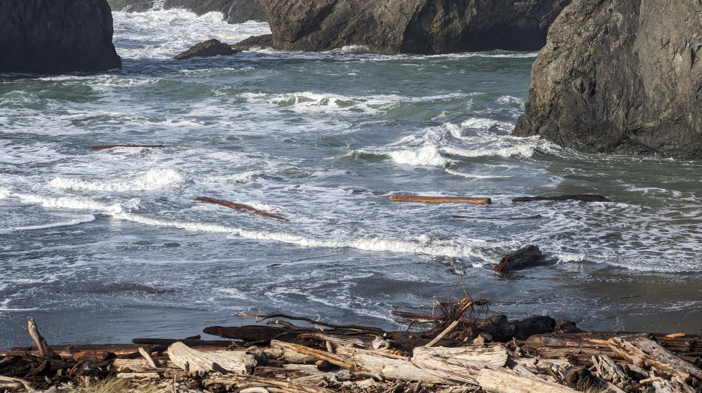
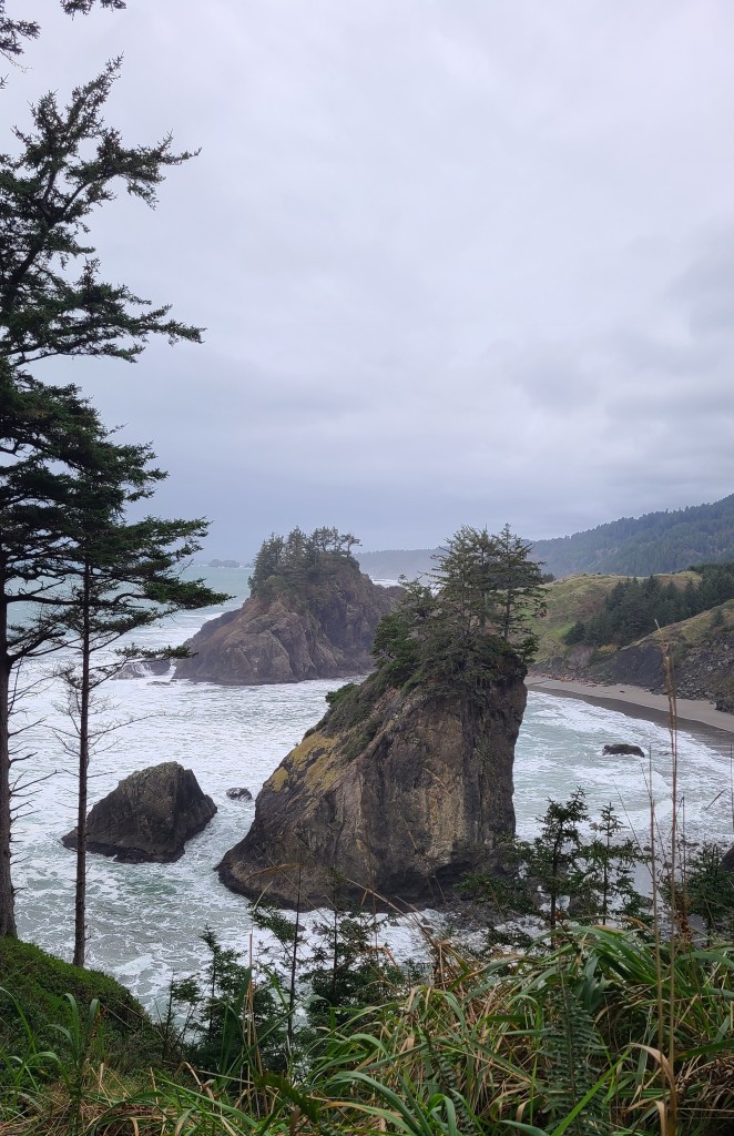
Meyers Beach is the first outcropping of rocks in the view from Cape Sebastian far left in the photo above.  Besides our home beach, Meyers Beach has been our favorite.  Not only are the sea stack formations amazing, but they are home to lots of starfish, anemone, muscles and barnacles among other sea life.  That feature will have to wait for another post see “starfish”.  This about the rock formations and driftwood. 

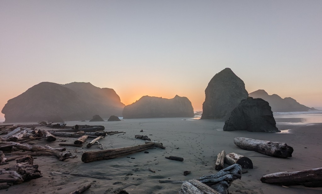
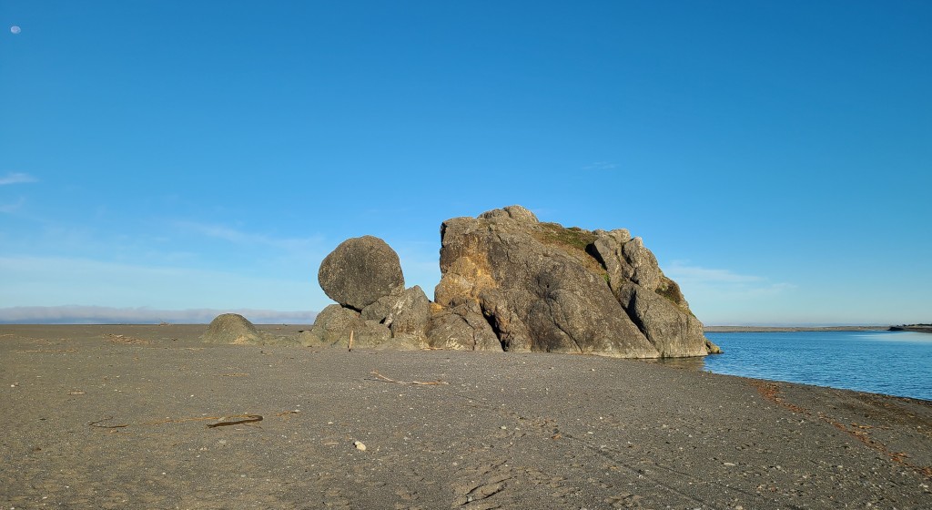
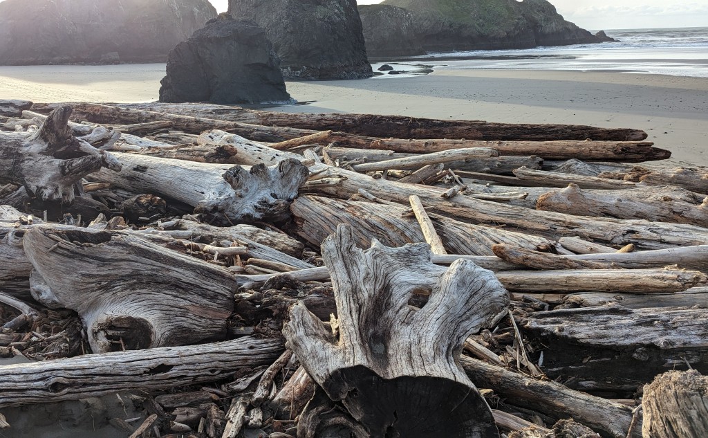
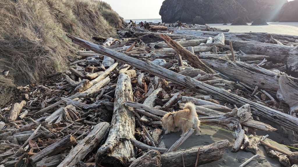
The first couple of times we visited Meyers access was no problem and the large driftwood was amazing.  But during the King tides and winter storms we watched some of the driftwood floating around in the waves all being rearranged on this point.  The next time we came to see the starfish access was blocked by the largest pile of driftwood, it was amazing how much it had changed. 

Pistol River is just south of Meyers and hosts a major windsurfing competition later in the year.  Not much of a town really just a community, sorry no pics.

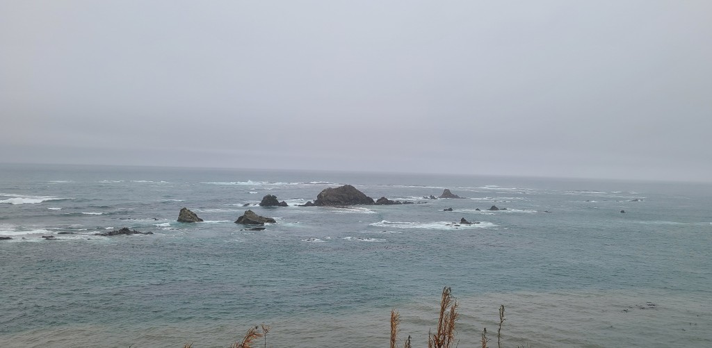
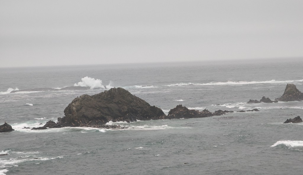
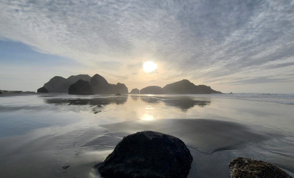
Samuel H Boardman State Scenic Corridor is an approximately 13 mile long stretch of Hwy 101 ending in Brookings.  Sam Boardman was the founding father of Oregon State Parks and this magnificent part of the highway is dedicated to him.  Here are just a few of the scenic spots along the corridor.

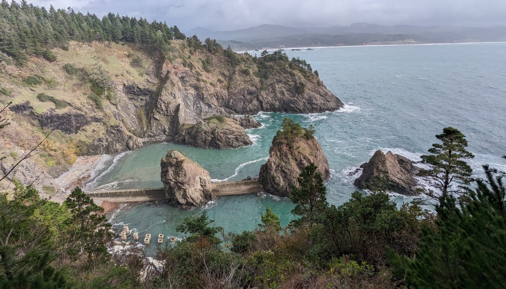
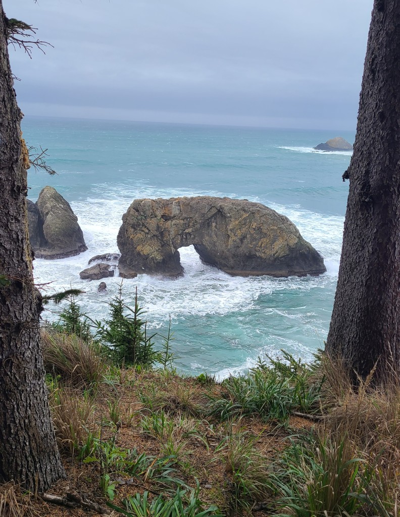
Arch rock.  Although there are many Arch rocks in the area this one is probably the most famous because of the improved trail to the overlook, picnic area and bathroom. 

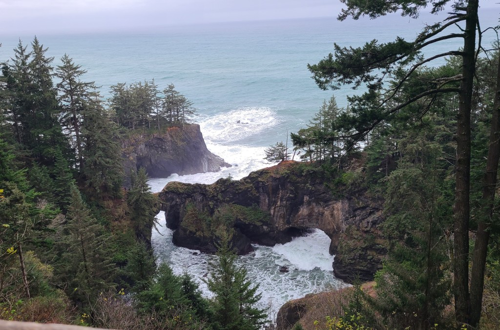
Natural Bridges, which are actually kind of arch rocks too.  If you look closely there are at least 3 natural bridges or arches in the rocks.  This area is very dangerous with steep slopes and bare slippery rock especially when wet, we of course stayed behind the barriers but others don’t and some die. 

Whales Head Beach and the rock that looks like a whales head breaching the water.  I read on line that it was named that because if the waves were right it looked like a whale blow, I didn’t believe it, thought it was just due to the shape of the rock.  But I was wrong…

Cape Ferrelo has a couple of overlooks and a nice relatively short trail.  These stops are where we got to see the grey whales on their southern migration, but that will be another post too.  Couple pics of our hike out on the cape and looking north to Whaleshead Beach. 

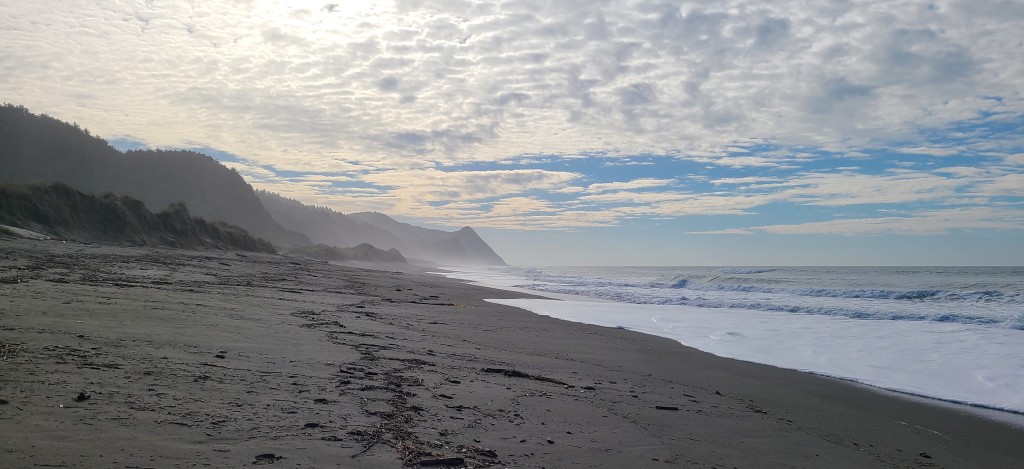
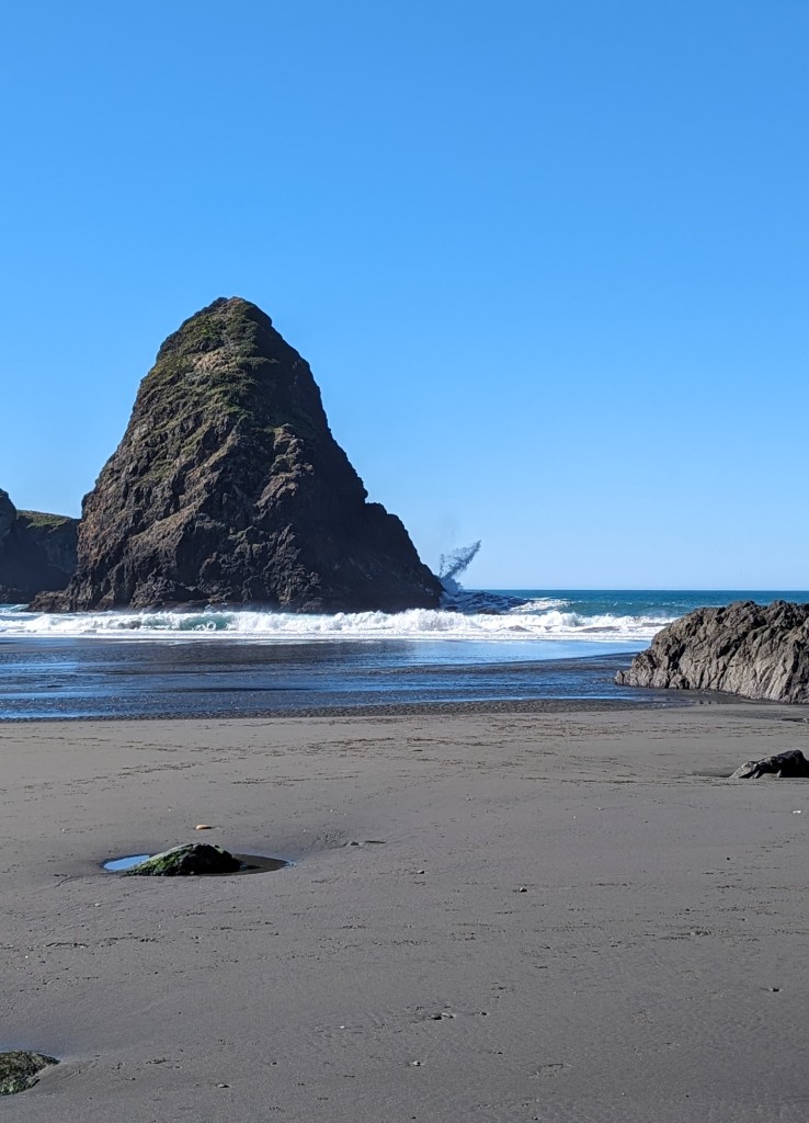
Finally Lone Ranch Beach.  This is a nice sandy beach with lots of rocks and sea stacks.  Our hike out Cape Ferrelo had a nice view looking down on this beach.  It is also easily accessible via a paved trail with parking close to the shore level.  Many places you have to scramble down large dunes/rocks/driftwood to get to the beach. 

I talked in another post about the inlet of Hunter Creek and its movement along the shore, there are also many small creeks that empty into the ocean, but are not large enough to really be called inlets.  They are interesting in that at each hightide this “ïnlet” disappears underwater and re-carves its path each day.  There are lots of these. 

Peace Love and gratitude for Sam Boardman!!

Gold Beach to Port Orford

Highway 101 on the southern Oregon coast is arguably the most beautiful stretch of coastal highway in the country.   We are fortunate enough to have spent this winter smack dab in the middle of it in Gold Beach.  About 30 minutes north is Port Orford a very small town (population 1,200) that claims to be the oldest coastal town in Oregon and about 30 minutes south is Brookings a much larger small town at the mouth of the Chetco River.  In-between are numerous state parks, accessible beaches and lots of beauty. 

Gold Beach is located at the mouth of the Rogue River.  It is a very small town of about 2,200 people and the county seat of Curry County.  Its most notable attractions are the Mary D Hume and the Isaac Lee Patterson Bridge. 

The Mary Hume was built in Gold Beach around 1880 as a steam ship hauling goods up and down the coast and later as a whaler/fishing vessel in and around Alaska until it was returned to Gold Beach and retired in 1977.  It later sank in the harbor and there it still sits. 

The opened in 1932 and has a distinct art deco feel to it.  It was built by an Eureka, CA engineering company and designed by Conde McCullough a renown Oregon engineer.  It is quite pretty and a major scenic structure in the town. 

Port Orford was home to a lifesaving station out on Port Orford Head.  There is lots of history surrounding this station, that we were unable to learn about because the museum was closed for the winter, but the well-maintained trails are beautiful and protected from the wind by the forest they wind thru.  Looking out at the surrounding coast and seastacks it is obvious why a lifesaving station was required. 

Another interesting thing about Port Orford is their Port.  They are home to large fishing fleet, but in the marina or harbor the boats are not kept in the water.  They are all hoisted in and out of the water and kept on wooden trailers and rolled around to the cranes or storage areas.  They do have a name for it, but I can not remember what it is…

On the way to Port Orford is a beautiful rock formation named “Sisters Rock”.  Every time we pass it we sing song Sisters Rock, because we believe that our sisters really do ROCK!!  We took a day hiking down to it and walking around, what a beautiful day and rocks. 

Looking north from the rock formation you could see rainbows in the off spray of the waves.  We had never seen this occur, but did several more times at different places on our stay this winter.  Guess maybe the sun has to be at the lower winter angle for this to occur??  Not sure you can tell in the pictures, but we can in our memories.

North of Port Orford Hwy 101 goes inland which is why I limited the most beautiful section.  But north of PO is Bandon and Coos Bay/North Bend.  We had occasion to visit each a couple of times, but really nothing to report.  Bandon’s rock formations are as beautiful as ever.  So, on the way to Bandon and destinations north you pass thru Langlois, a town consisting of a general store, church and two cross roads.  Anyway, their welcome sign says “world famous”, but for what.  They are world famous for the hotdogs sold at their general store…  So one rainy day with nothing to do we drove up to get hotdogs for lunch.  Don’t get me wrong they were not bad, but really not that great in our opinion.  No pictures, but true story.

Peace Love and lesson learned: World Famous does not necessarily mean its good!!!

Winter in Oregon – Turtle Rock

We landed in Gold Beach, OR for the month of November and are just now leaving the end of April.  It has been an interesting winter, a little cool and wet for our taste but nice for a change of pace.  We stayed at Turtle Rock RV Resort on Hunter Creek and the beach is just across Hwy 101.  So here is our  home for winter 2023-2024. 

The beach here is mostly sandy with a couple of prominent rock features and banks of rocks (as opposed to shells) that come and go based on sand movement.  Turtle rock named for obvious reasons.

And Kissing Rock – named that because it is/was a place where people stop to make out. We kissed each time we visited.

One of the most interesting things here has been the movement of the inlet of Hunter Creek into the Pacific Ocean.  Initially the creek turned north before u-turning and emptying into the ocean.  But during a pretty severe storm early in our stay there was so much water coming down the creek that it broke thru the sandbar and made a straight inlet to the ocean.  The extra high king tides during this same time had the ocean almost completely covering the beach, you can see the water all around Turtle Rock. 

These early storms brought a lot of debris down from the surrounding mountains on to the beach.  We sat safely in the coach watching large branches and full trees floating down the creek.  Here is some of the debris that ended up on the beach.  Guess this is where at least some of driftwood on the beach originates. 

Here you can see how far the inlet has moved during our stay.  Notice the houses/condos in the background, very far away at times and right across the inlet others. 

 As another example of the severity of the storms and the power of water look at this large tree trunk that one day was laying on the beach and a couple of days later is snagged high on the close by rocks.  The tree is still on the rocks as we prepare to leave. 

One of our favorite pieces of driftwood on our beach was this large stump.  Although it moved around from in the surf up to the dune line, it is still there but almost buried in the sand. 

Just some other views from our beautiful beach this winter.  Although others enjoyed it while stopping at kissing rock on their tour of the area, most of the time it seems like it was our private beach. 

Peace Love and amazement at the power of water.

Charleston, OR – State Parks and More

Just south of our campground in Charleston is the Cape Arago highway and three Oregon State Parks.  A large portion of this area, about 700 acres, was once owned by Louis J. Simpson a Coos County timber millionaire.  In 1910 he built a large estate named Shore Acres.  In 1921 after a fire destroyed the home, financial losses prevented the family from rebuilding.  The property was sold to the State of Oregon in 1942 for use as a park. 

What remains of his estate is currently a well-preserved botanical garden and a couple of out buildings.  Since our visit was in October the gardens were not in full bloom, but the beauty was evident.  They were decorating for the holiday light festival which is very well known in the area.  The colored lights appeared to be decorating the plants as they would look when in bloom, so at least we could tell what color the blooms would have been. 

The rest of the estate is spread with trails an enclosed observation station and access to these gorgeous rocks.  The waves crashing and stirring around the rocks were mesmerizing.  Very interesting rock formations, notice the uplifting angle, absolutely incredible. 

There is also a nice overlook at Simpson’s Reef, presumably named after the estate owner.  This reef encircles a small gathering of rock islands.  The reef provides a safe harbor for various sea creatures including seals and sea lions.  They are very active and vocal.  We could watch them play for hours.  But they are a pretty good distance away, binoculars and zoom lens made it better. 

At the end of the highway is the Cape Arago State Park.  It is a loop road with several different parking and trail/access areas.  Our first visit we saw a whale blow right around these rocks.  We wouldn’t have seen it if others had not pointed it out, it was quite exiting and our only whale sighting so far…

A gentleman we met on the beach around our home base clued us in on a trail from Cape Arago where seals and sealions like to hang out that is a much closer view than Simpson’s reef.  So cool to get some local knowledge every now and again. 

It is reported that Sir Francis Drake sought refuge in this small little cape way back in 1579.  Wow just Wow.  The main overlook in the park and a sunset. 

Sunset State Park is also on this highway and looks like a great place.  But it is mainly a campground and adjoining beach, and we already have that.  So, we took in the view and moved on.  And one last look at Cape Arago Lighthouse looking north this time. 

We did take a day trip to Bandon, first to check out the beautiful rocks and also to try the fish tacos on the water front.  Another suggestion from one of the guys we met on the beach.  Friendly folks.  Absolutely love this beach and rock formations, the fish tacos were pretty good as well.  No starfish this visit, the tide didn’t seem to be as low as on our visit years ago??  We’ll figure this out, but that will have to wait for a later post.  I can’t imagine a better display of coastal sea stacks… and of course the famous face rock.

Peace Love and grateful to experience happiness daily. 

Charleston, OR

Our first stop on the Oregon coast was Charleston a very small town just south of Coos Bay/North Bend.  Randy was able to score the cutest campsite right on a sandy beach, only about 100 yards from our door to the beach.  We were in heaven.  It also happened to be on the edge of about 5 miles of Oregon State Parks and various gorgeous overlooks.  We stayed in Charleston for two weeks and barely left the campground.   Would have stayed longer but they were a bit pricey and had a 28 day limit on our stay.

The beach directly in front of our home for the week connected to the north with Bastendorff Beach a county park and further on to the jetty and entrance to Coos Bay.  The bay is an active shipping port, we saw ships entering and exiting almost everyday.  And on the really foggy days we didn’t see the ships, but the fog horns signaling their presence were heard loud and clear.   It seems that they export wood chips, we assume a by-product of logging activity in the area, to Japan. 

The beach to the south was pretty closed off during high tide, but at low tide Yoakam Point and this little secrete beach was accessible.  Although we never got caught on this beach with the tide rising, I believe that at high tide the water was against the rocks, i.e. no beach and sheer cliffs.  The rock faces were amazing.

There were some anemones on the rocks at Yoakam Point which made us think of our visit years ago to Bandon.  So, one day we did make the trek to Bandon trying to time low tide to possible see the starfish, see later post about Bandon.  Here are some Yoakam anemones.

The weather changed frequently from fog to sunshine and from rain and drizzle to clear skies.  The ocean also changed dramatically while we were there.  Large surfable waves to large washing machine choppy mess to beautiful flat blue water.  We frequently walked to the jetty and back, and got a nice view of the Cape Arago Light house looking south.

We were fortunate enough to catch a little color from sunrises and sunsets, although most were not very spectacular.

Peace Love and Gratitude for making it to the other coast.

Grants Pass, OR

Next stop Grants Pass.  We stopped there for a couple of reasons, first because we would be in the cone of totality for the “ring of fire” solar eclipse and the minor issue of needing tires for the Wanderlodge.  Remember there are eight to replace, also remember that Oregon doesn’t have sales tax so we saved a bit on that about one tire free, yea for us!!  We also got to finish off Randy’s birthday with a visit to Trader Joes in Medford nearby.  Someone (you know who you are) sent a gift card for CHOCOLATE and boy did it deliver. 

You will be happy to hear we are still working on the supply, but its close to gone…  Thank you loving sister and BFF. 

The tires were and adventure of their own including studs breaking off and us running around town in a flurry late on Friday afternoon only to have the logger truck guy help fix it at the last minute.  All worked out great but it was quite stressful.  We live in this thing, so the choices were fix it or have us campout in your parking lot until you do. Luckily it worked out and we had this beautiful campsite right on the Rouge River.

On to the eclipse.  Our forecast was for cloudy skies and we had neglected to look around for viewing glasses.  The weather report said that two hours east in Klamath Falls would have the best possibility of viewing.  So we found one pair of glasses from 2017 and got up early to drive to find the eclipse.  There were clouds around and as you can see here we were so fortunate to get as good of a view as we did.

Sharing the glasses and of course trying to take pictures out of said glasses was a challenge, but well worth the effort.  So glad we made the trip and that the clouds mostly cooperated.  We did see the total eclipse in 2017 and it was completely different.  Still an amazing experience!!

Some pictures kind of had reflections.  Thought they were pretty cool and showed the shape of the sun/moon better than the actual thing. 

Peace Love and Gratitude for the amazing universe that we are aloud to live in.

Lakeview, Oregon

Just because we decided to head to the Oregon coast doesn’t mean that it will be an easy direct route getting there.  We have to take approved roads when traveling in the Wanderlodge; if not weight limits, overpass heights among other things could present challenges  that we are unwilling to undertake.  From where we were our routs were limited, but the most direct route into Oregon and westerly is state road 140 and the Doherty Slide.  Doherty Slide is a 4 mile decent carved into the side of a mountain with a drop off of over 1,000 feet.  The pictures don’t do justice, but you can look it up on you tube if you are interested. 

This whole area of Oregon is so remote from leaving Nevada we drove almost 4 hours and really didn’t see a town of more than 100 people.  We landed in the big city of Lakeview, Oregon population almost 2,500.  It is known as the Tallest Town in Oregon because of its elevation at 4,700 feet. 

There is not a lot around Lakeview, but the Abert Rim and its geology was interesting enough for us to visit.  If you follow us you may remember the “scarp” we saw in Idaho on the Peaks to Craters scenic drive.  Well, the Abert Rim is one of the highest fault scarps in the US.  It is over 2,500 feet tall and stretches over thirty miles. 

At the base of the Abert Rim is Abert Lake which is one of the only salt water lakes in Oregon, notice the salt residue as the lake recedes.  The other side of the lake looks like sand dunes, but we suspect it is really grassy fields turned golden in the fall. 

Also found a US Forest Service road with some lovely aspen trees in full fall color and a nice picnic spot.

Peace, Love and Gratitude for the amazing world we live on!!

Nevada

So Hmmmm where to go from lovely Hagerman??  US Hwy 93 runs straight down all the way thru Nevada and further so we decided that would be a good starting point US 93 south.  We have not really visited much of Nevada so why not.  We stopped in Wells for a week. 

We visited Angel Lake in the Humboldt National Forest.  Beautiful small lake up around 10,000 feet. Nice cool weather and lovely Aspen in yellow. 

Some other views of the valley below and of the Chimney Rock above in the Humbolt Mountains. 

Utah and the Bonneville Salt Flats is just an hour drive to the east.  These salt flats are the left overs of a large ancient Lake Bonneville which covered approximately 1/3 of the state of Utah, the lake receded after the last ice age over 10,000 years ago.  The remaining salt crust is almost 5 feet thick in places tapering off to an inch or less as you get to the edges.  They also use the salt flats to race/test extremely fast cars.  Going hundreds of miles an hour.  They were not racing when we were there as the flats were full of water.  We assume that it is a very shallow lake, but a lake none the less. 

While in Wells, we continued to debate where to spend the winter and how to get there.  Arizona is always an attractive option and we could travel directly down Hwy 93 for most of the trip.  Southern California or Baja Mexico are options, and we could travel a little west and skirt the eastern edge of the Cascades on the way down.  Ultimately we decided to try southern coast of Oregon or northern coast of California or both…

First stop on our way west, Winnemucca.  Most exciting thing we did in Winnemucca was drive up this mountain. 

The views from the top were really amazing.  But absolutely no fall color in the trees simply because there are absolutely no trees…

Peace Love and grateful to visit a little more of Nevada!!

Hagerman, ID

As I said we really liked Hagerman, especially this time of year.  The shade on a hot day is very nice, at least 10 degrees cooler.  Read a lot and just enjoyed the pleasant temperatures as well as peace and quiet.  Although the campground seemed to have decent turnover, it was mostly quiet older folks.  Very few families, probably because they really didn’t have much for amenities, which suited us perfect.  And school is back in session.  And did I mention it was very cheap, which really suited us.  So, we stayed a couple or three weeks. 

And a couple of really special things happened while we were there.  They had their annual car show.  Just so happens this is a really nice car show and brings in folks from all around.  Fancy cars are a thing in these deep winter snow zones.  Nothing better to do than baby a car in the garage for 6 months a year.  Notice Nellie finding her shady zone.  The food trucks in attendance were good too.

We also visited the box canyon.  During our travels there have been numerous box canyons but this is the first one that explained what a box canyon is.  Not sure that this definition is applicable to all we have seen, but works for us.  A box canyon is a canyon that only has one opening, with three sides of steep wall.  Most were created via a massive catastrophic flooding event in our ancient history, not being cut over time by flowing water.  Here is the source of this canyon, where a creek sometimes flows into it.  It is mostly fed by the springs below. 

The canyon runs probably a mile or a mile and a half to the Snake River.  There was a (try at your own risk) trail to the canyon floor and several people were taking it, but we played it save and walked the upper trail.  It was warm with no shade which Nellie was disappointed with, but very beautiful. 

Riding along the Snake River on Hwy 30 you see lots of weeping waterfalls and several large ones as well.  Here are some of the weeping walls, amazing that there is that much water freely flowing into the river, yet they have to turn off a waterfall because they need more water…  Not sure that we really understand, but so it is. 

And then the most amazing thing happened, we received a lemon pound cake all the way from NC compliments of Millie the best ever Ma.  Since we got this special cake, someone had to have a birthday and since it was Randy’s birthday we celebrated.  Many of you and our other loved ones helped to make the day more special by sending love and cards.  Thank you all the calls, cards and general good love; it was much appreciated.  Randy had a fantastic 60th birthday!!!

Peace Love and thank the goddesses for 34 years married and many more to come!!  We had an anniversary in Hagerman too…

More Twin Falls, ID

When we were here before we were still determined to not pay for entertainment.  This is pretty much still the case, we are very choosy about what we pay to do as there is so much to experience with no expense.  Shoshone Falls is a City of Twin Falls Park and charges $5 per car entrance fee, therefore we skipped it in 2020. 

This time around, we decided to visit the “Niagara” Falls of the west.  Packed our picnic and off we went.  Upon arriving and paying our fee we discovered that they had turned the falls off.  Turned them off!!  We didn’t know that water falls could be turned off until 2020 when we visited the Twin Falls.  At that point only one of the twins was actually falling, the other had been turned off. 

Anyway, here is what the falls looked like in 1932.

And this is what they look like the day we visited.  We understand that it is not always turned off, but the water is too important to surrounding farmers and other uses to allow it to flow year around.  Kind of explains why the river had so little flow while kayaking. 

The surrounding canyon was beautiful, but we came to see the waterfall. 

Also, just to continue my bitch about paying to visit a turned off waterfall, the picnic was not very pleasant either we were surrounded by bees.  Good for the flowers, but an aggravation for a picnic. 

Just a little down the river we went to the sight of Evel Knievel’s attempted jump over the snake river.  If you were alive in 1974 you were probably an Evel Knievel fan and excited to see this jump.  It was a failed event, some say it failed due to the parachute deploying to early.  Who really knows, but the jump was not successful. 

Here is what remains of the ramp (from both top and botton) and a picture across the canyon where he was supposed to land. 

We were in Hagerman on 9-11, Twin Falls had a remembrance ceremony as they usually do and also hung an American Flag over the canyon.  It is suppose to be the largest American Flag ever…  Not sure about that, but it was impressively large.  It hung there at the Perrine Bridge for at least a week, glad we got to see it.

And of course the towns memorial to Evel Knievel.

Peace Love and Never Forget!!!